 |
| Skaneateles Conservation Area trail map (PDF version) |

The town-owned conservation areas within the Town of Skaneateles.

Map update at the Guppy Falls parking lot kiosk.

Federal Farm and associated areas on Old Seneca Turnpike and Gully Roads.

Federal Farm and Gully Road properties with terrain and elevations shown.

Timber stands described in the 2000 Forest Stewardship plan drawn up by DEC forester Charles K. Porter.

The Federal Farm and Gully Road areas.

Skaneateles Conservation Area Soil Types

Town of Skaneateles tax map overlaid on 2009 Farm Service Agency satelite map, showing the various Skaneateles Conservation Area acquisitions: 1. Original Town Dump, 1930s – 1970s 2. Landfill purchased from U.S. Government in 1970s, now transfer station 3. Purchased from Fitzgerald Estate in 1989 4. Donated in memory of Ralph & Mary Bishop in 1998 5. Gift from U.S. Army in 2001 6. Guppy Farm purchased from Kathleen Evans in 2002 7. Purchase from Monica Pitman-Atkins in 2005 8. Michael O’Loughlin property acquired in 2008

Satelite view of Federal Farm and adjacent areas.

Mabel M. Reynolds Nature Preserve topographic map (USGS-ESRI).

Mabel M. Reynolds Nature Preserve countour map with tree types listed.

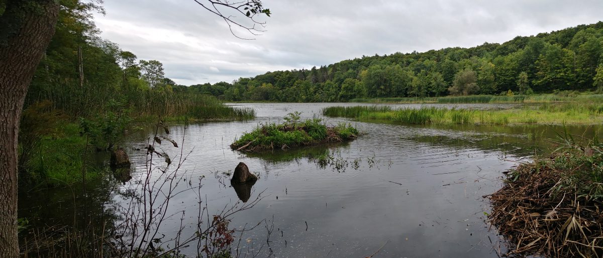
Dunning tract with wetlands indicated.

Dunning property in yellow.

Tax map of Dunning tract overlaid onto a satelite image of the area
