
There are currently three geographically separate town-owned conservation areas located in the Town of Skaneateles in Onondaga County, New York:
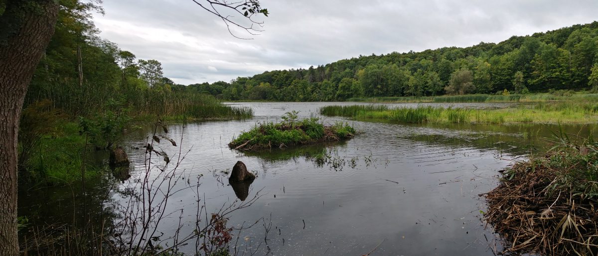
1. The Skaneateles Conservation Area (SCA), including the Federal Farm and Gully Road areas, located at Old Seneca Turnpike and Gully Road, in the northeast part of the town, contains about 345 acres of land, much of it wooded, a man-made (or man-enlarged) fishing pond, a beaver pond, wetlands, waterfall, observation decks, pavilion, picnic tables, and lean-to for camping (by permission only). The SCA is located in the Onondaga Lake watershed and in DEC Wildlife Management Unit 7F.
2. The Mabel M. Reynolds Nature Preserve, on both sides of Benson Road, at Reynolds Road, in the southwest part of the town contains about 123 acres of woodland. The Reynolds Preserve is located in the Owasco Lake watershed and in DEC Wildlife Management Unit 7J.
3. The Dunning tract, a landlocked property behind Grace Chapel on the south side of US Rt. 20 at its intersection with NY Rt. 175, contains about 90 acres of land, about one third of it wooded. The remainder is being leased for agricultural purposes. The Dunning tract is located in the Skaneateles Lake watershed and DEC Wildlife Management Unit 7J.
| Summary of conservation areas within the Town of Skaneateles . | |||||
| Property | Parcel name | Year(s) acquired | Tax map ID | 2008 acres | 2014 acres |
| Federal Farm & Gully Road |
Old town dump | 1941, 49, 59 | 30-02-27.0 | 2.32 | 2.32 |
| Transfer station | 1971 | 30-02-04.0 | 72.40 | 72.40 | |
| Fitzgerald | 1989 | 30-02-03.3 | 10.00 | 10.00 | |
| Bishop | 1998 | 29-02-07.0 | 2.05 | * | |
| Federal farm (E) | 2001 | 30-o2-05.1 | 143.37 | 143.37 | |
| Federal farm (W) | 2001 | 30-o2-28.0 | 3.73 | * | |
| Guppy farm | 2002 | 29-02-08 .1 | 57.67 | 63.43 | |
| Pitman-Atkins | 2005 | 30-02-25.0 | 6.15 | 6.15 | |
| O’Loughlin | 2008 | 30-02-03.1 | 47.04 | 47.04 | |
| Federal farm & Gully Rd. subtotal: | 344.73 | 344.71 | |||
| Mabel M. Reynolds Nature Preserve | Reynolds (SW) | 2005 | 59-01-18.1 | 46.70 | 46.70 |
| Reynolds (NE) | 2005 | 59-01-18.3 | 67.57 | 67.57 | |
| Reynolds (NC) | 2005 | 59-01-18.4 | 5.38 | 5.38 | |
| Reynolds (NW) | 2005 | 59-01-18.5 | 3.57 | 3.57 | |
| Mabel Reynolds Preserve subtotal: | 123.22 | 123.22 | |||
| Dunning Tract | Dunning | 1973 | 42-05-04.1 | 101.1 | 88.9** |
| All town conservation areas total: | 569.05 | 556.84 | |||
| Notes: * In current tax maps, the Bishop (29-02-07.0) and Federal farm w. (30-o2-28.0) parcels are shown as having been merged into the Guppy farm parcel (29-02-08 .1) **In 2012, 12.2 acres of the Dunning tract (42-05-04.1), adjacent to the Grace Chapel property and US Rt. 20, was sold to Grace Chapel. |
|||||
| Sources: 2014 Tax maps – http://ocfintax.ongov.net/Imate/taxmaps.aspx 2014 Assessment roll – http://ongov.net/rpts/documents/RPS150T50.pdf |
|||||
