The Skaneateles Conservation Area includes the old “Federal Farm” and several Gully Road parcels. It is located on the south side of Old Seneca Turnpike and both sides of Gully Road in the northeastern quadrant of the Town of Skaneateles. It surrounds the Town of Skaneateles transfer station on Old Seneca Turnpike. Directions.
 Skaneateles Conservaton Area trail map
There are four parking lots (listed from north to south):
- The Old Seneca Turnpike lot, just east of the transfer station on the south side of Old Seneca Turnpike, provides access to the old “Federal Farm” part of the conservation area, including the fishing pond, pavilion, observation platform, lean-to, and miles of trails.
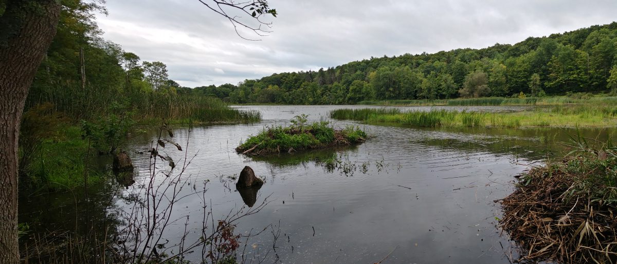
- The O’loughlin lot, on the east side of Gully Road provides access to the old O’loughlin and Fitzgerald properties, which contain a beaver pond, picnic area, and beautiful hemlock trees.
- The Bishop lot, on the west side of Gully Road sits across the road from the beaver pond and also provides access to the Guppy Farm area.
- The Guppy lot on the west side of Gully Road provides access to Guppy Falls and the Guppy Farm area.
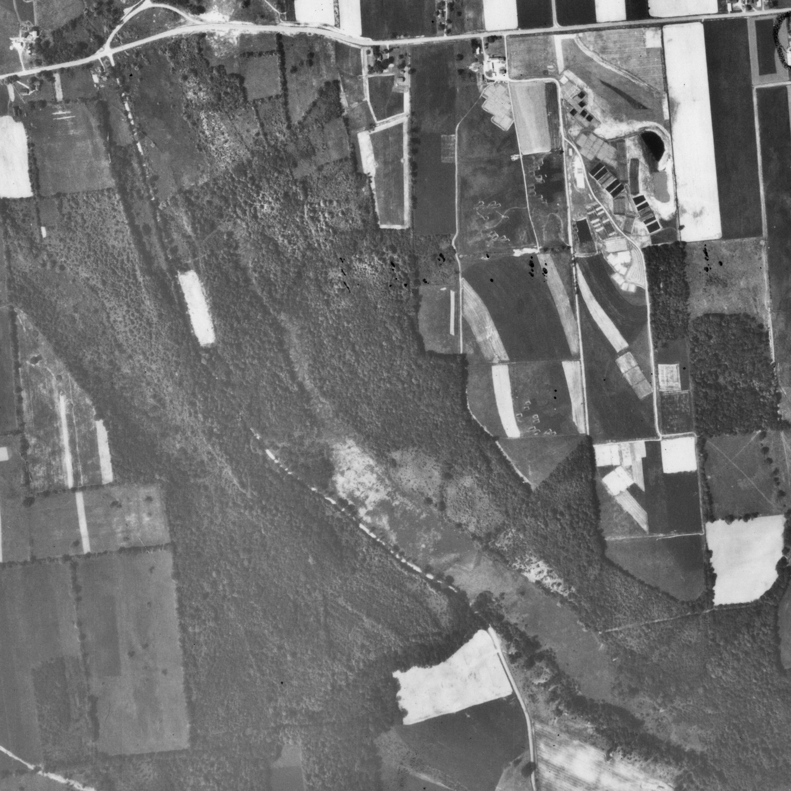
1938
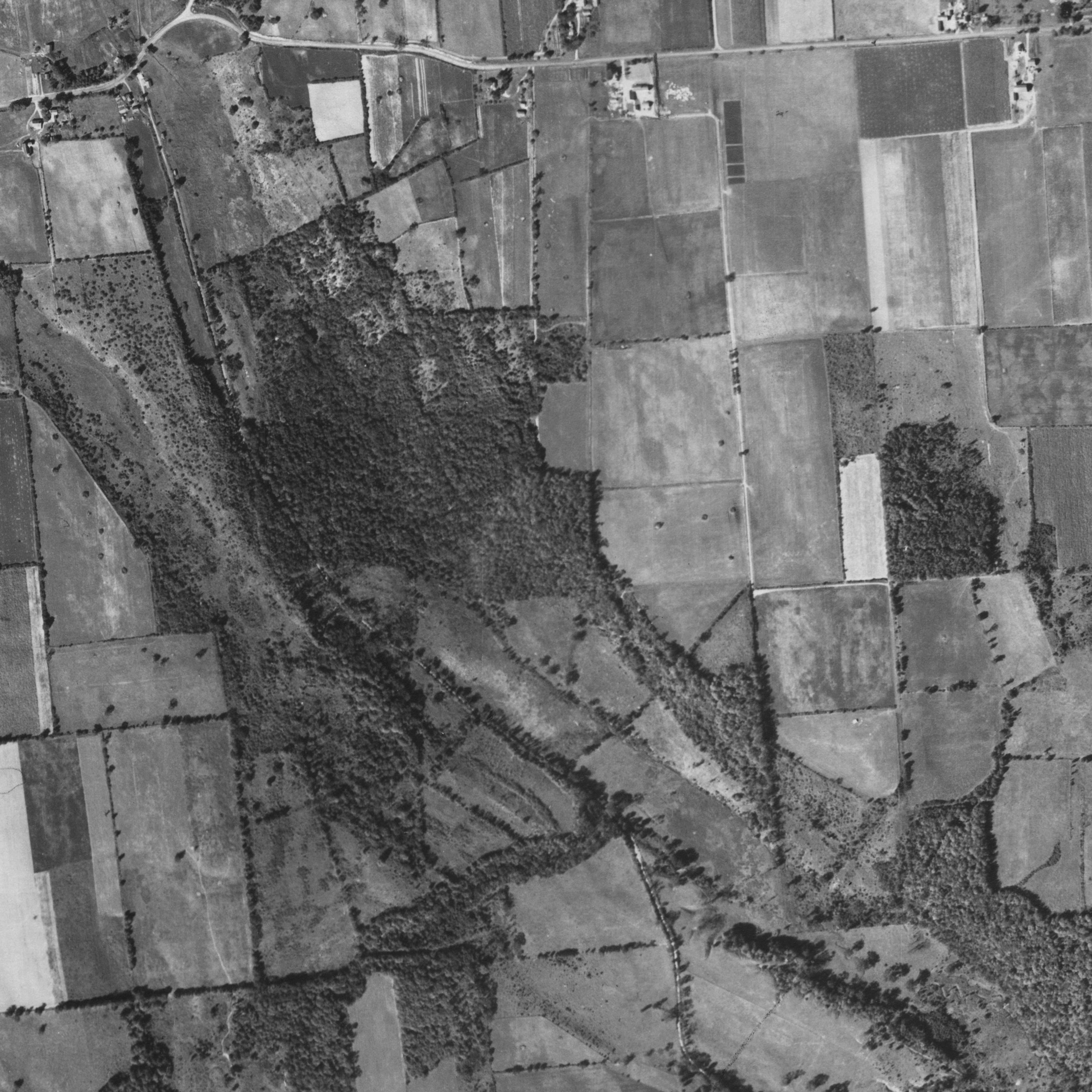 |
| Aerial view of USDA Soil Management Research Farm and Gully Road properties, Sep. 5, 1938. Cornell University Library |
1951
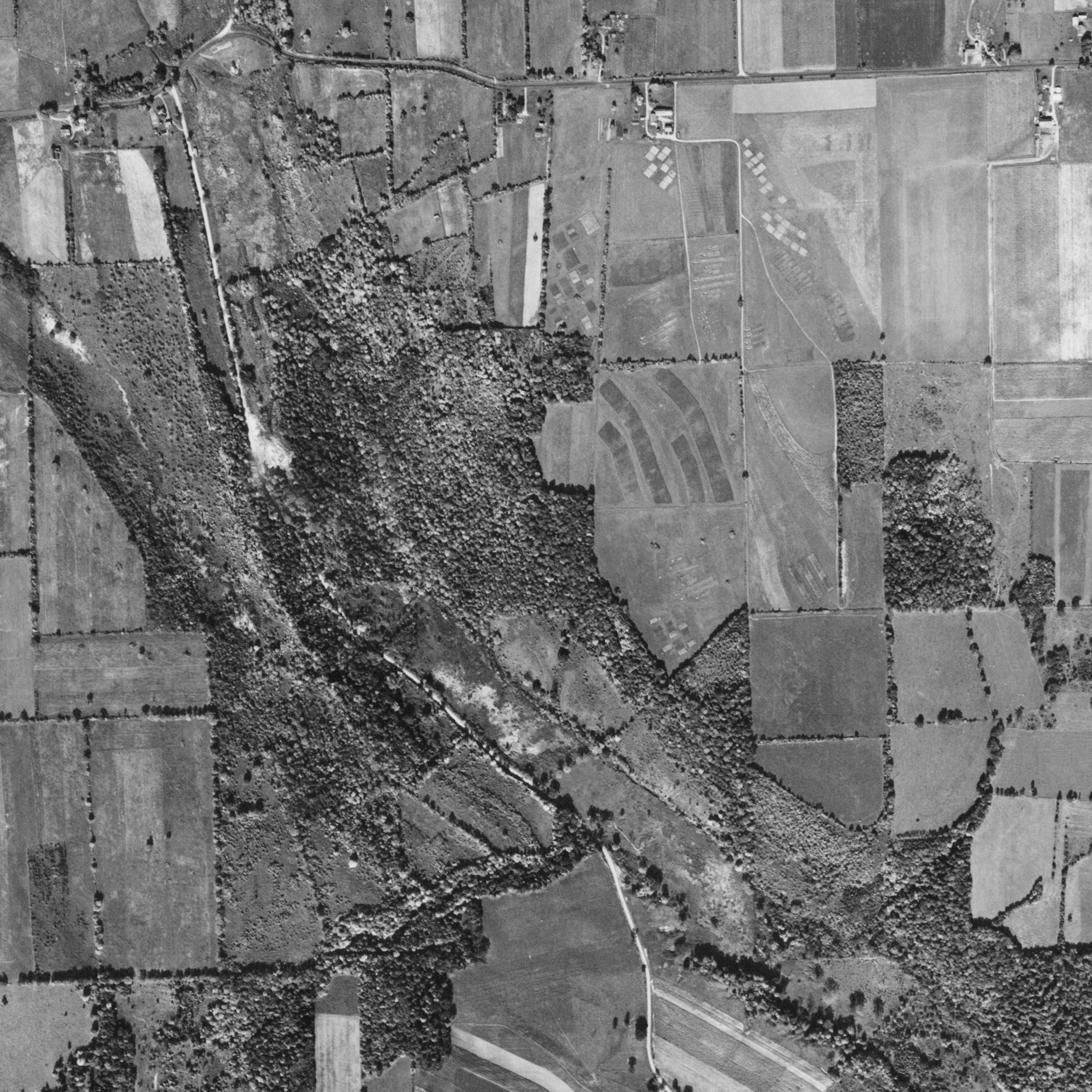 |
| Aerial view of USDA Soil Management Research Farm and Gully Road properties, Oct. 5, 1951. Cornell University Library |
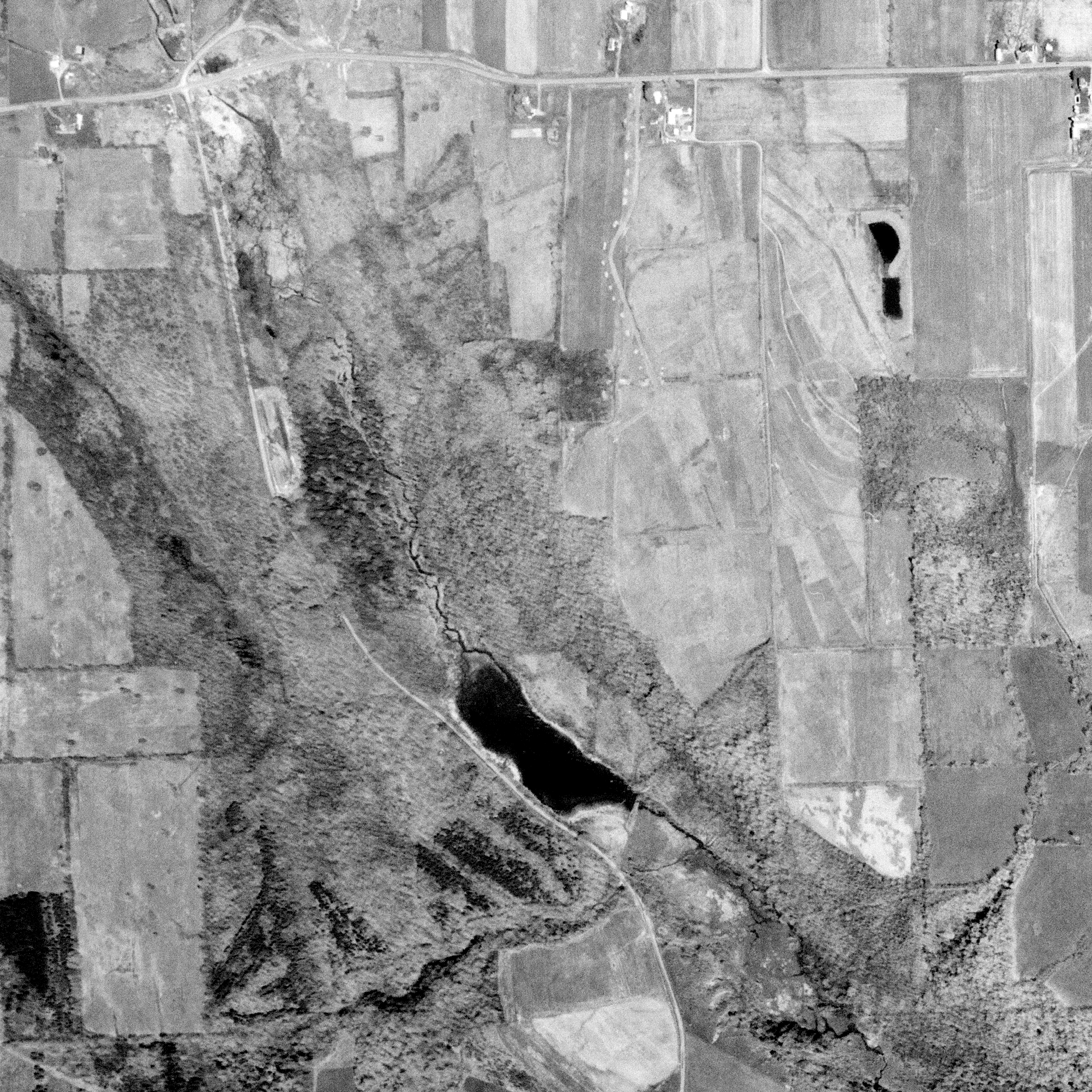
1957
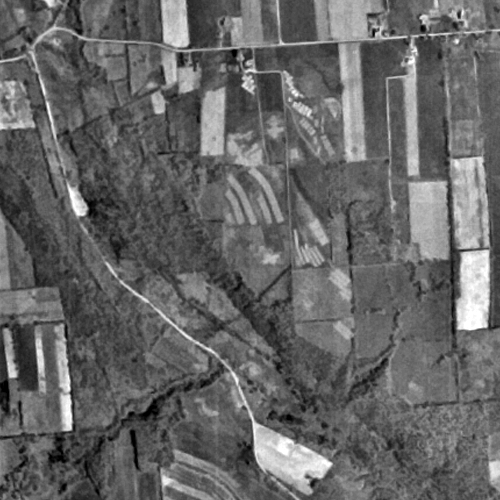 |
| Aerial view of USDA Soil Management Research Farm and Gully Road properties, April 16, 1957. USGS. |
1966
 |
| Aerial view of USDA Soil Management Research Farm and Gully Road properties, Jun, 22, 1966. Cornell University Library. |
1972
 |
| Aerial view of the Federal Farm and Gully Road, May 12, 1972. USGS. |
1995
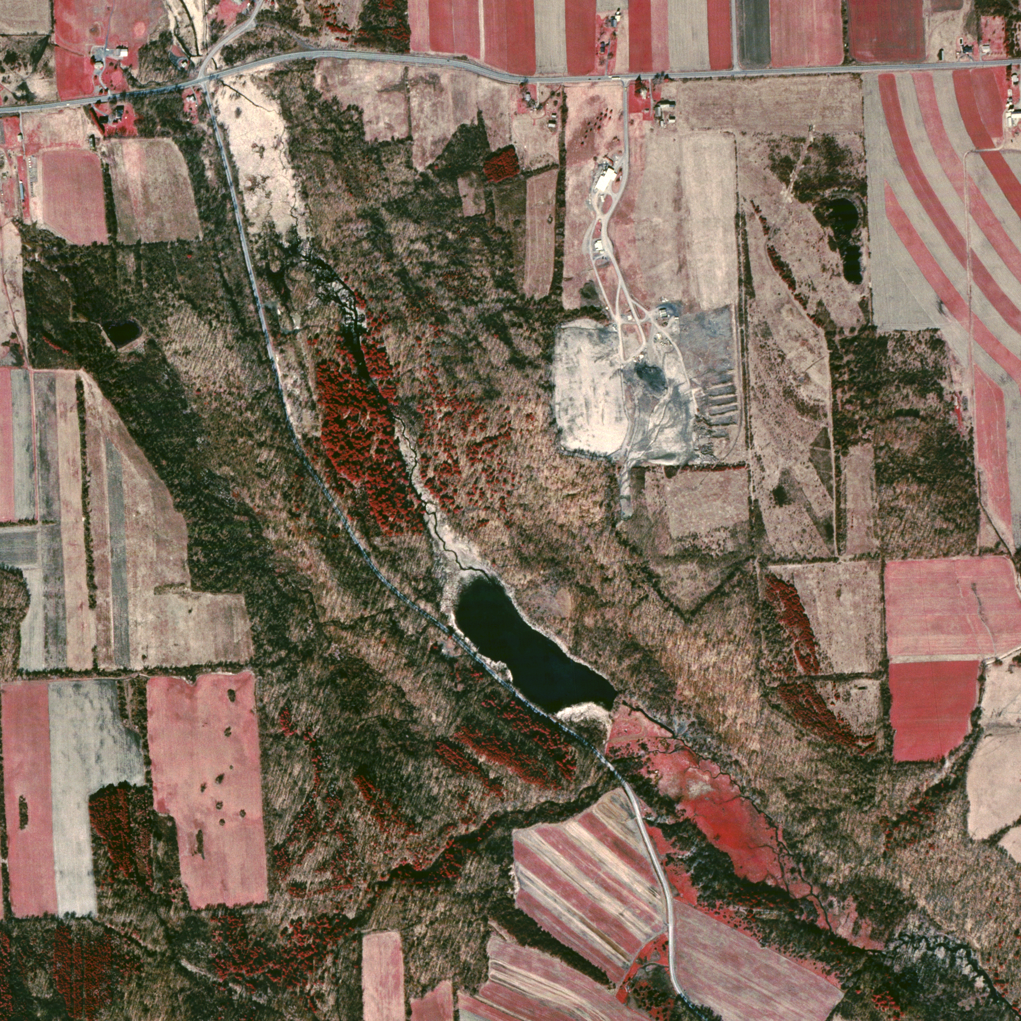 |
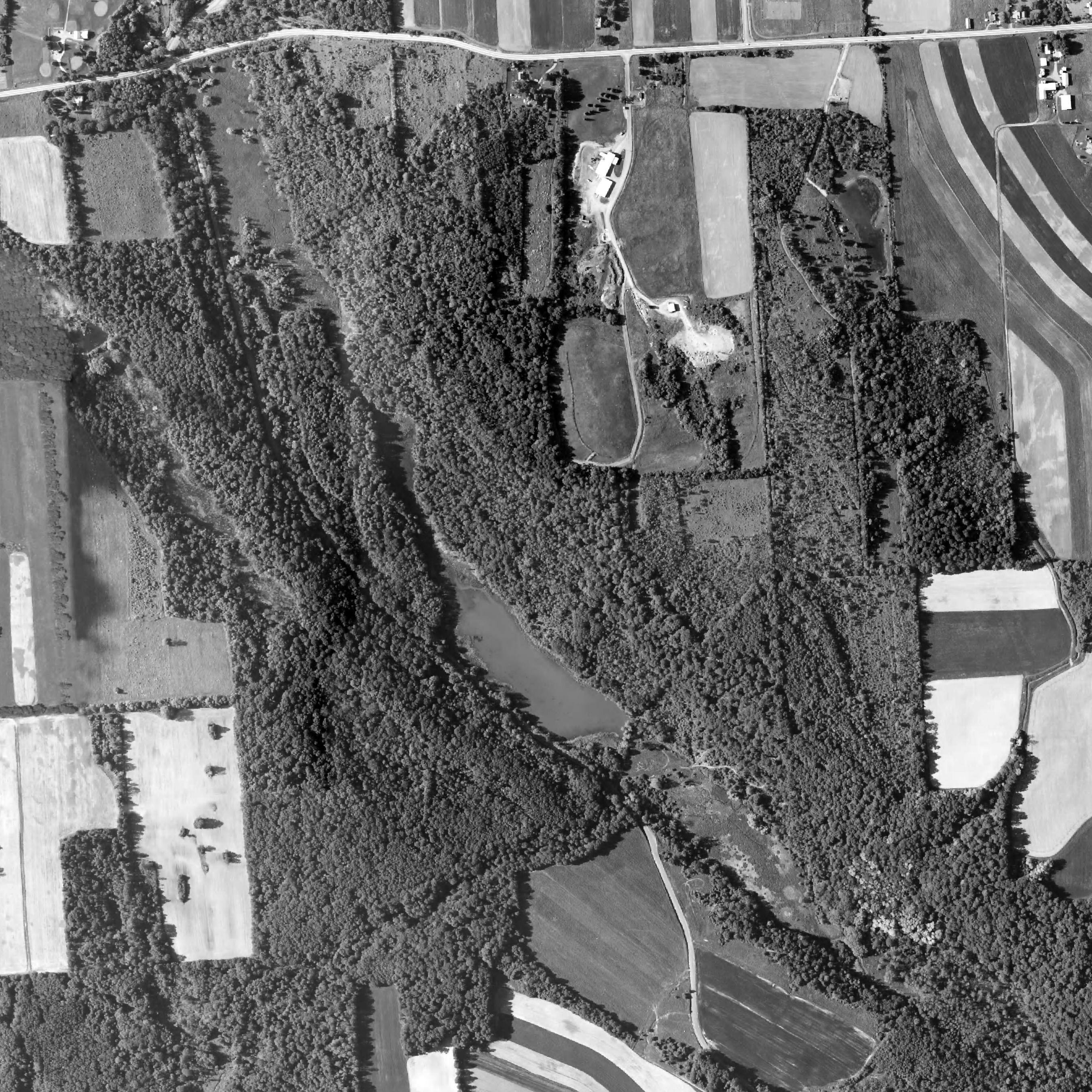
| Federal Farm and Gully Road infrared image March 27, 1995. USGS |
2000
 |
| Aerial view of Federal Farm, Gully Road, and Transfer Station ca. 2000. |
2012
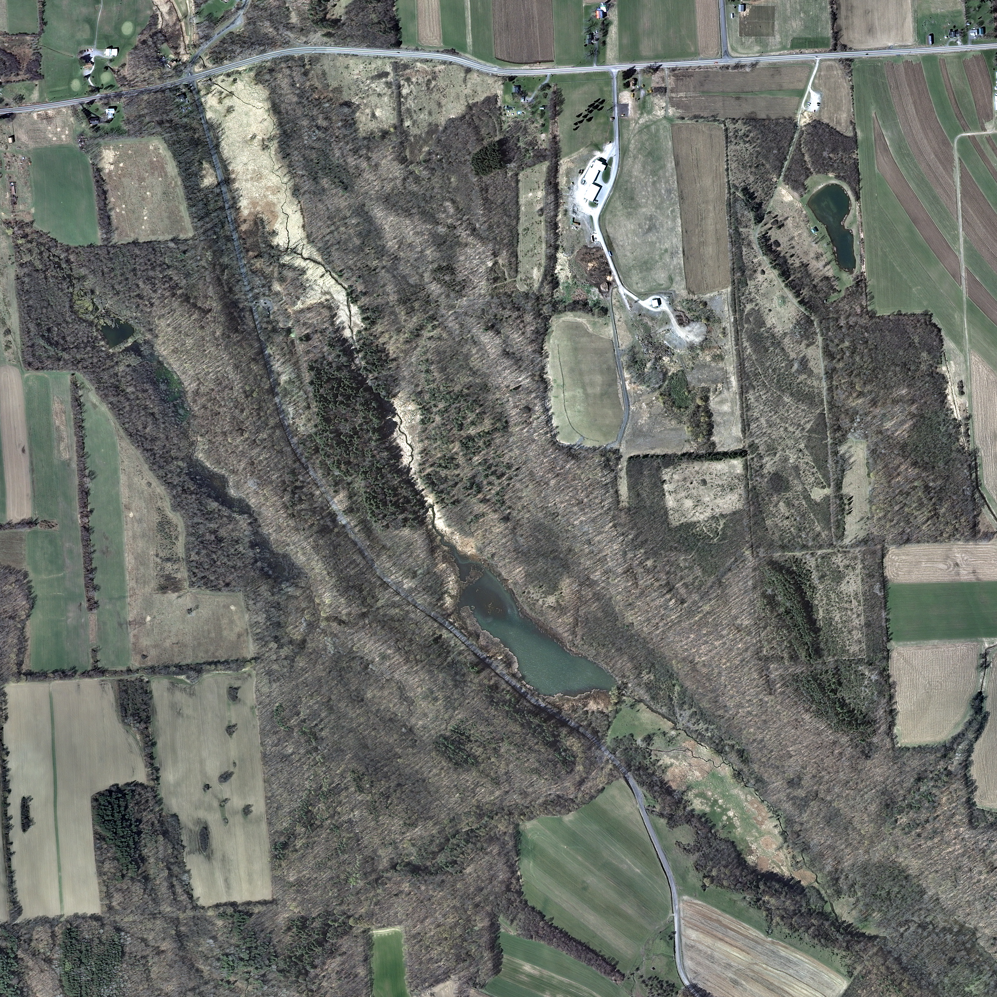 |
| Old Seneca Turnpike and Gully Road Conservation Area and Transfer Station, April 3, 2012. USGS |
2013
 |
| Old Seneca Turnpike and Gully Road Conservation Area and Transfer Station, June 4, 2013. USGS |
2014 neighbors
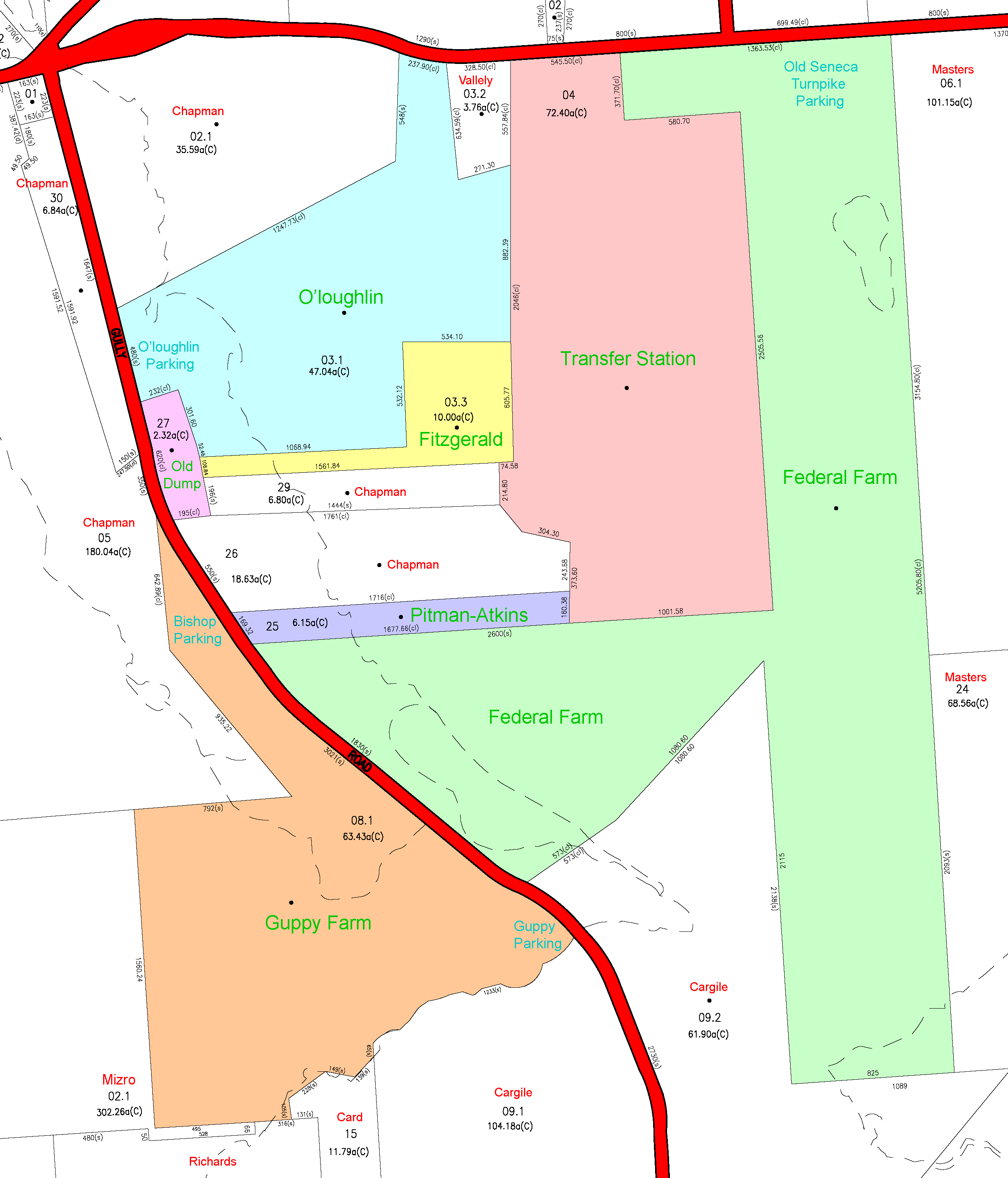 |
| Old Seneca Turnpike and Gully Road Conservation Area and Transfer Station (colored) and neighboring properties in white, with current owner names in red. From March 2014 county tax map 030. |
Contour map
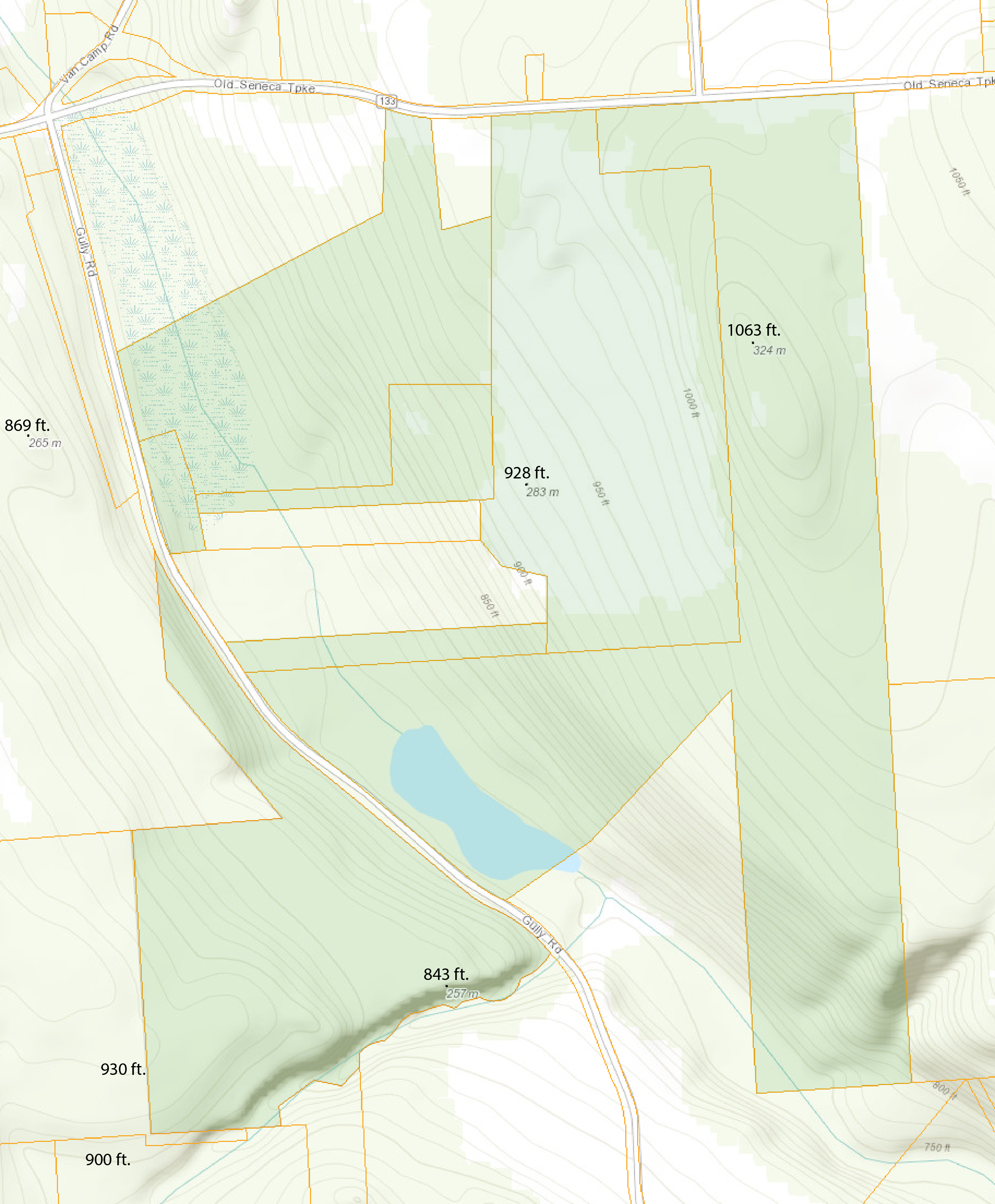 |
| Old Seneca Turnpike and Gully Road Conservation Area with terrain and elevations shown. |
Land aquisitions
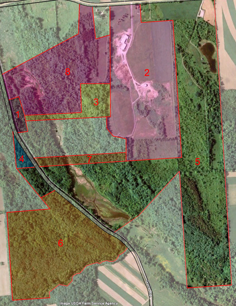 |
| Town of Skaneateles tax map overlaid on 2009 Farm Service Agency satellite image, showing the various Skaneateles Conservation Area acquisitions:
1. Original Town Dump, 1930s – 1970s |
