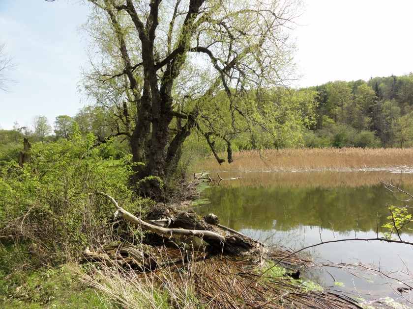
Southern Beaver dam on Gully Rd. Rosa multiflora at left, Phragmites australis at right, May 3, 2012.
The common reed (Phragmites australis) has become a serious environmental threat through much of North America and is quickly becoming widespread in wetland and not-so wet areas of the conservation area. It is present in the Bill Pavlus fishing pond on Old Seneca Turnpike and several parts of the beaver pond and adjacent wetlands on Gully Road. It can also be found on the transfer station property. It is basically a large perennial grass that forms dense sands that crowd out most native plants. Aside from the ecological harm that this presents to natural areas, this also causes problems keeping the artificial fishing pond clear for recreation, as it is much harder to pull out than the native plants that it displaces.
A large majority of the stand in the fishing pond was excavated and removed in May 2015 by the Skaneateles Highway Department, and was purportedly buried in the “hardfill” area at the transfer station. The remaining plants, which were too deep and far from the shore for the excavator to reach, were pulled out by volunteers in early July of that year. These were carefully laid on top of a nearby brush pile to hopefully dry out and decompose before making ground contact. Because of the deep water, there was little hope that the rhizomes had all been removed from the bottom. This area needs to be closely monitored, and re-occurrences dealt with as soon as possible.
On Nov. 3, 2015, SCA committee members met with George Spak, a licensed pesticide applicator, at the conservation area. In addition to our numerous other invasive plants, we discussed the Phragmites problem and investigated the some of the infestations around the lower Gully Road beaver pond. George agreed to provide an estimate for treating plants with herbicide once he got a rough measurement of the area of the infestation. We provided him with a rough measurement of 50,000 square feet.
Native Phragmites
It should be noted that there are native North American lineages of Phragmites australis, but it is very unlikely that any of the populations at the conservation area are native. In fact, in New York State, the only vouchered population of the northern native lineage (P. australis subsp. americanus) is in and around Montezuma Swamp, where it grows along with the exceedingly more prevalent Eurasian subspecies. Interestingly, even though the native and introduced subspecies often grow in close proximity to each other, and appear to be very similar to each other, it was just in the year 2014 that the discovery of a naturally occurring hybrid between the two was formally published. That discovery was made at Montezuma Swamp, and as of the publication date it was the only place that natural hybridization between the two subspecies had been documented.
May 3, 2012. Southern Beaver dam on Gully Rd. Rosa multiflora at left, Phragmites australis at right. Most of what is visible here is on the Cargile property.
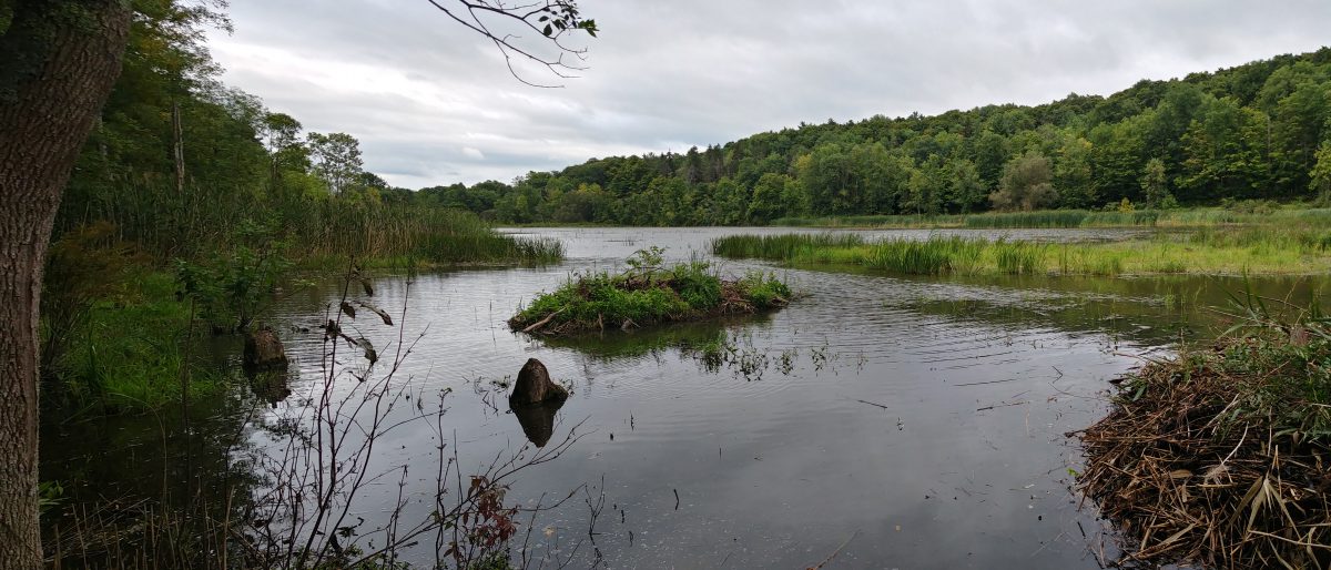
May 3, 2012. Below southern beaver dam on Gully Road. Phragmites can be seen across the water above the dam.
July 11, 2013. Phragmites australis on the southwestern edge of the beaver pond on Gully Road.
Dec. 21, 2014. Phragmites near lower beaver dam on Cargile property,
Dec. 21, 2014. Phragmites australis infestation on the west side of the lower beaver dam on the property line between the SCA and Cargile farm.
Dec. 26, 2014. Phragmites australis in in the fishing pond. Facing east toward the Masters farm. This was removed by the Highway Department the following spring using an excavator.
Dec. 26, 2014. Phragmites on west side of landfill. These are normally not mowed like the rest of the landfill is, though they were this summer. Assume that the location is too wet to mow most years. Rhizomes penetrating the landfill membrane could be a concern.
Dec. 26, 2014. Phragmites in a ditch at the south end of the transfer sation. This was mowed this summer, but it was difficult because is is a rocky ditch. The plants have regrown and some have gone to seed.
Dec. 26, 2014. Phragmites near south end of transfer station.
Dec. 26, 2014. Phragmites at the south end of the transfer station.
Dec. 2015. SCA initial Phragmites assessment from iMapInvasives, showing approximately an acre of infestation (in yellow)
Feb. 2016. Second GPS measurement after most of the Phrag had been trampled to make treatment easier. The measurement still came out to about 50K square feet, or about an acre. This includes both dense infestations (where few if any other plants are present) and areas where Phragmites stems are scattered among other vegetation, usually on the edges of the dense infestations.
June 30, 2016. ESF intern Tyler placing logs on edges of black poly tarp on mowed Phragmites. The two 20×30-ft. black-poly tarps were taped together using “tarp tape.” But within a few hours of laying them out in the bright sun and securing the edges using logs, the adhesive on the tape softened and the tarps separated from each other by a couple of feet. These are 6.0 ounce black poly tarps, waterproof, mildew proof, tear and acid resistant. They have an 11-12 mil thick, 14×14 weave count.
July 31, 2016. Phragmites growth after one month. Tarps had shrunk from the heat.
Sep. 21, 2016. Aerial photo by Matt Champlin. Looking westward from the lower beaver dam near the SCA/cargile property line.
The red elipses show approximate Phrag locations. The blue elipse shows sbout where the dam breach is. The yellow dashed line is about where the SCA/Cargile property line crosses the wetland. Lower part of image is southeast and Cargile property. Above line northwest and town property.
Sep. 21, 2016. Aerial photo by Matt Champlin
Oct. 16, 2016. Large Phragmites infestation on northeast side of the ephemeral beaver pond on Gully Road, about 3.5 months after last mowing of the Phrag in the picture. Most Phrag is now over 6-feet high, but only a small proportion have gone to seed.
Oct. 16, 2016. Phragmites litter pile after the northern tarp was moved to the east.
Oct. 16, 2016. Test trench (about 8 feet long and 30-inches deep). Phragmites litter pile at left.
Oct. 16, 2016. Trench at about 2 feet deep. Still seeing rhizomes at this depth. At about 30-inches, the appearance of rhizomes seemed to diminish, and water just started to collect at the bottom of the trench. At that point it was filled back in, and loose roots and rhizomes were thrown onto the adjacent tarp to dry out.
Oct. 16, 2016. Roots and rhizomes of Phragmites from a test trench in an infestation covered with black tarp during the Summer.
Oct. 16, 2016. Phragmites rhizome from a test trench where a 20×30-ft. black tarp was removed after having covered a part of an infestation during the summer of 2016.
Oct. 16, 2016. Raked pile of Phragmites litter from area that tarp on the left was moved from. Some of the roots and rhizomes from test trench were thrown onto tarp at left. Standing Phrag behind tarps is at least 6-feet tall.
Oct. 16, 2016. Phragmites infestation on Chapman property on east side of Gully Road, just upstream from the SCA.
Topographic map of the Skaneateles Conservation Area and environs.
The SCA is near the eastern town line.
Baltimore Woods Nature Center is across the town line in Marcellus, just downwind of the SCA.
The Phragmites infestations of concern are in the wetland area on the northeast side of Gully Road.
The Phragmites infestations surround an ephemeral beaver pond, whose existence depends on occasional beaver activity and the absence of Phragmites. These plants will form a dense monoculture that will exclude most other flora and fauna.
The Phragmites stands of concern all lie within a NYS DEC-designated wetland or the 100-ft. buffer zone. This will require that a freshwater wetland permit be obtained for any chemical or other substantial means of treatment.
The northern sources of water that flows to the SCA wetland are Mud Lake and the wetland between Hoyt and Chapman Roads, north of VanCamp Road.
The Pearl Lakes golf course is also a source of SCA water. This may be of some concern due to the typical use of fertilizers and pesticides at golf courses.
James Chapman’s properties lie on both sides of Gully Road, upstream from the Conservation Area. The parcel on the corner, immediately east of Gully Road and south of Old Seneca Turnpike contains a large Phragmites infestation that lies within a DEC-designated wetland that is shared with the SCA. On the west side of Gully Road, the Chapman farm and SCA share a federal (not DEC) wetland that is a source for SCA’s DEC wetland,
The Town of Skaneateles Transfer Station lies embedded within the SCA and is the frequent recipient of yard waste and construction debris that undoubtedly (and apparently) contains a large amount invasive plants, including Phragmites. There are at least five stands of Phrag (along with many other invasives) in the southern (back) part of the transfer station. These should at least be kept mowed at appropriate times to prevent being spread by seed to the conservation area and beyond.
The Cargile farm shares an infestation of Phragmites with the SCA just west of the beaver dam. Ideally, it would be best to treat the entire stand at the same time. Three streams flow separately from the SCA to the Cargile property: the beaver pond outlet, the Guppy Falls stream, and a stream that passes through the SCA from the Masters farm wetland.
SCA waters then flow through the “New Seneca Turnpike Pond,” listed as one of New York’s eBird Hotspots. From there it crosses into the Town of Marcellus and passes under Bishop Hill Road and Lee Mulroy Road near their intersection.
Finally SCA waters join with Ninemile Creek, which empties Otisco Lake into Onondaga Lake. Eventually of course, those waters that are not consumed or vaporized reach Lake Ontario, the St. Lawrence River, and then the Atlantic Ocean.