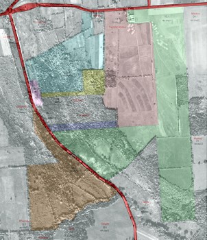
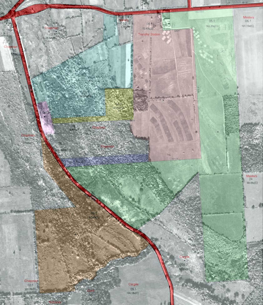
1951 Aerial photo of the USDA Soil Management Research Farm overlaid with the 2014 Onondaga County tax maps for the current Conservation Area properties.
1951 Aerial photo of the USDA Soil Management Research Farm overlaid with the 2014 Onondaga County tax maps for the current Conservation Area properties.
